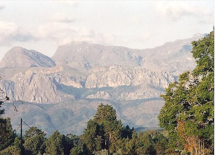
Zimbabwe is landlocked, and almost everything about its geography follows from that: the country sits on a high inland plateau between two rivers, the Zambezi to the north and the Limpopo to the south, with no coast of its own. That plateau shape decides where it is cool and where it is hot, where the rivers form a border rather than running through the middle of the country, and why the Eastern Highlands feel like a different country from the rest of Zimbabwe.
A plateau country
At 390,757 km²1, Zimbabwe is built around a broad, elevated plateau rather than any single mountain range, and the spread of its elevation shows how far that plateau rises and falls. The highest point, Mount Nyangani in the Eastern Highlands, reaches 2,592 m, while the lowest, at the junction of the Runde and Save rivers in the south-east, is only 162 m2 — a difference of over 2,400 m within one country. Most of what visitors see, including Harare and Bulawayo, sits on the high, cooler central section of that plateau rather than down in the lowlands.
The Zambezi and the Limpopo
The country’s two defining rivers both run along its edges rather than through its middle. The Zambezi River, 2,650 km long, forms the entire northern border with Zambia, and it is on this stretch that the plateau drops away at Victoria Falls, where the river falls 108 m over a width of 1,708 m3 into a basalt gorge. Further along the same river, Lake Kariba covers 7,770 km², Zimbabwe’s largest lake and now a destination of its own for houseboats and lakeside safaris. In the south, the Limpopo River2 marks the border with South Africa, draining the lower, hotter part of the plateau that most travel itineraries skip in favour of the cooler highlands further north.
Highveld, lowveld and the Eastern Highlands
Zimbabwe’s climate tracks this change in elevation closely: a hot lowveld and middleveld near the river valleys, a warmer belt across the rest of the middleveld and highveld where most people live, and a distinctly cooler zone in the Eastern Highlands2, the mountain spine running along the border with Mozambique that includes Nyanga, Mutare and Chimanimani. This is the part of the country captured in the Chimanimani scene above: green, hilly and noticeably cooler than Harare or Victoria Falls, which is why it draws hikers rather than the wildlife-focused travellers who head for the lowveld parks instead. The gap between the hot river valleys and the cool highland spine is wide enough that packing for both ends of a single Zimbabwe trip means planning for two different climates, not one.
What this means for a trip
Because the country’s geography is really a plateau dropping toward two river borders, the landscape itself tells you what each part of a Zimbabwe trip is for: the river valleys for Victoria Falls, Lake Kariba and the wildlife areas along the Zambezi, the high central plateau for the cities and getting around, and the Eastern Highlands for cooler hiking away from both. See the where to stay and when to go pages for how that terrain translates into an actual route and season.