_Z1oSaii.webp)
Kariba exists because of the dam it is named after. The town was built in the mid-to-late 1950s1 by the contractor Costain to house the workforce raising the 128-metre-high Kariba Dam across the Zambezi, a project that ran from 1955 to 1959 and was opened by the Queen Mother in May 19602. The dam backed the river up into Lake Kariba, the world’s largest reservoir by volume3, and the town has lived off that lake ever since. Most people come for the same reasons locals stayed: fishing, house-boating and a close look at the dam wall that made the lake in the first place.
Getting oriented
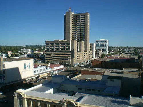
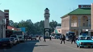
The town sits on hilly ground above the lakeshore and splits into three distinct areas. Mahombekombe, closest to the water, is the older and poorer of the two high-density suburbs built for dam workers; Nyamhunga, a little further out, is the newer one. Kariba Heights1, up on the hilltop, is the wealthier suburb and the one with the lake views; it holds the Catholic church built there in the early 1960s and is still where many of the better lodges sit. None of this is sightseeing in itself, but it explains why a lodge “in Kariba” can mean anywhere from lakeshore level to a hilltop drive above it.
Highlights
The Kariba Dam wall is the obvious first stop: a 579-metre-long, double-curvature concrete arch2 that most visitors view from a lookout point or cross on foot or by car on the way to the Zambian border town of Siavonga on the other side.
Lake Kariba itself is the reason most people are here at all. Houseboating, fishing for tiger fish and bream, and sundowner cruises along the shoreline are the standard activities, and the lake’s scale means a short cruise barely covers a fraction of it: it runs 223 km long with a surface area of 5,580 km²3.
Operation Noah is the story behind the lake’s wildlife. As the water rose between 1958 and 1964, a team led by game ranger Rupert Fothergill rescued more than 6,000 animals4, among them elephants, rhinos and lions, stranded on shrinking islands, and moved them to the mainland, most of it into what became Matusadona National Park. Local operators still tell the story on lake cruises past the islands where it happened.
The local crocodile farms are a lower-key stop, usually combined with a half-day tour, and a reminder that the lake itself has a healthy crocodile population that keeps most swimming off the lakeshore itself rather than the hotel pools.
Getting around
Kariba Airport, in the facts box above, has scheduled flights from Harare and Victoria Falls, and is the easiest way in for a short visit. By road, it’s a roughly 365 km drive from Harare5, via the A1 to Makuti then the P12 down the escarpment to the lakeshore, on a route that takes most of a day. Inside the town, distances between the lakeshore, Kariba Heights and the dam wall are short but steep, so a car or a hotel shuttle beats walking in the heat. A ferry service also runs across the lake to Mlibizi, for travellers heading on to Victoria Falls without doubling back through Harare or Bulawayo.
Where to stay by area
Lakeshore lodges put you closest to the jetties for houseboats and fishing charters, which is what most visitors are here for. Up on Kariba Heights, the hotels and lodges trade that convenience for a cooler hilltop setting and views out over the lake, worth it if you’d rather watch the sunset from altitude than from the water’s edge. Either works for the one or two nights most people spend in town before or after a houseboat trip.
Day trips
Matusadona National Park, across the lake and covering 1,400 km² of shoreline and escarpment, is the main day trip, reached by boat from Kariba town6 rather than by road. It’s known for elephant and buffalo along the shoreline, plus the handful of black rhino that remain from decades of relocation and anti-poaching efforts, and a boat safari from Kariba is the practical way to see it without booking a multi-night stay in the park itself.
_Tg7jU.webp)