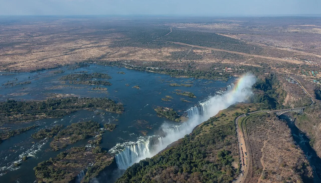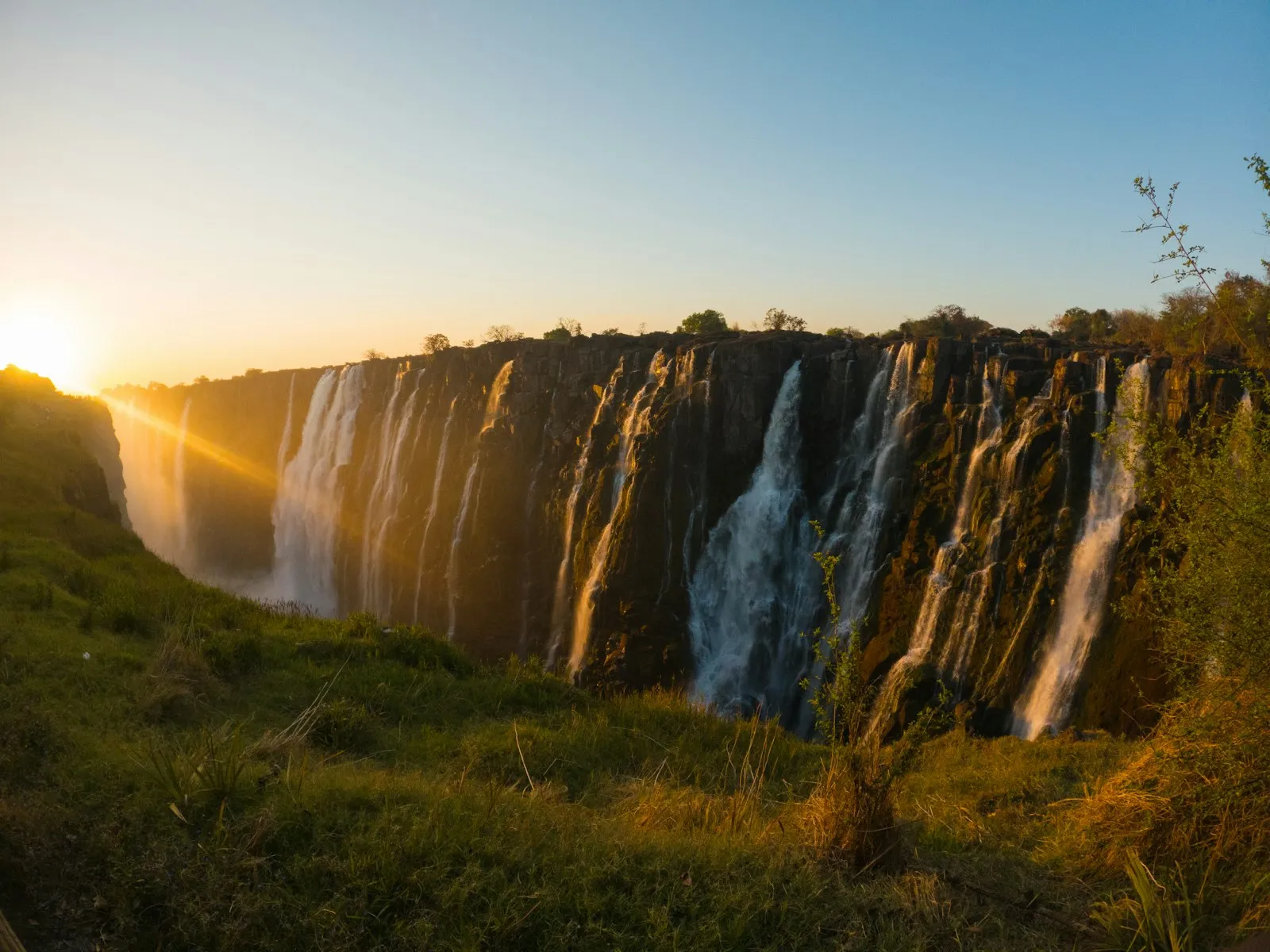
Zambia is a landlocked country in southern Africa that consists mostly of high plateaus cut by river valleys, and at 752,614 km²1 it is the 39th-largest country in the world. Victoria Falls is a waterfall on the Zambezi River, on the border between Zambia and Zimbabwe2, and both Zimbabwe and Zambia have national parks and tourism infrastructure at the site. UNESCO lists it for Zambia as Mosi-oa-Tunya / Victoria Falls, a World Heritage Site since 19893.
Regions and main cities
Lusaka is the capital, and it lies at the junction of the main highways to the north, east, south and west, at an altitude of 1,300 m. Its markets set up, upgrade and clear away thousands of stalls every day, from motor spares dealers and fruit sellers to salaula4, stalls of discarded clothing from the West sold to Africa by the bale.
Livingstone, named after the explorer David Livingstone, was made the capital of Northern Rhodesia in 1911, and the capital moved to Lusaka in 1935. Today the town is a base for visiting Victoria Falls5, and adventure companies there offer river boarding, white-water rafting, canoeing, horse-riding trails and abseiling.
South Luangwa is where the walking safari originated, and the concentration of animals around the Luangwa River and its oxbow lagoons is among the most intense in Africa. The park covers 9,050 km²6, and about 400 of Zambia’s 732 bird species appear there.
Lower Zambezi National Park covers 4,092 km²7 and lies opposite Mana Pools National Park in Zimbabwe. That section of the Zambezi is considered fairly calm and predictable, and for this reason seasonal fishing, boating and canoeing are popular there.
Kafue National Park, in the centre of western Zambia, is the oldest and largest8 of the country’s national parks at 22,400 km², yet it remains little-known and largely unexplored.
Getting there and around
Kenneth Kaunda International Airport, 14 km4 from central Lusaka, receives most international flights. You can also fly directly into Livingstone at Harry Mwaanga Nkumbula International Airport5, and Livingstone has regional flights from Cape Town, Nelspruit, Johannesburg and Nairobi.
Overland from Zimbabwe, you cross at Victoria Falls Town over the Victoria Falls Bridge and drive about 11 km to Livingstone; from Botswana the crossing is at Kazungula, about 60 km away. By road, Livingstone is 470 km5 from Lusaka.
For the parks, Proflight Zambia flies from Lusaka to South Luangwa all year6, with Mfuwe International Airport as the hub, and lodges do transfers from the airport. Lower Zambezi is a short flight from Lusaka7 to the Royal or Jeki airstrips, the quickest way in but likely the most expensive. If you drive yourself, UK government advice, still current in October 20269, says many roads are severely potholed10, and it lists abandoned vehicles, pedestrians, stray animals and vehicles driven without lights as hazards outside the main towns after dark.
When to go
The rainy season runs from November to April10, when sudden floods can wash away bridges and roads. On the Zambezi above Victoria Falls the annual flood season is February to May, with a peak in April2.
In South Luangwa the dry season begins in April and intensifies through to October, the hottest month, when game concentrations are at their height close to the remaining water. The wet season there runs from November to the end of March6, and the migrant birds arrive in droves during those rains. In Kafue the dry season runs from June to October8, and most of the park is inaccessible from November to April. For Lower Zambezi the best time is July to October7, though virtually all lodges and canoeing operators are open from about April to November.
Money, safety and visas
National park entry is charged per person per day, and it is one of the costs to plan for: in 2025 international visitors paid USD 25 a day11 in South Luangwa and Lower Zambezi and USD 20 in Kafue. Zambia Tourism’s fee list says the fees are subject to change without notice, so check them before you leave.
On risks, the Dutch government’s 2026 advice is code orange, essential travel only, for the border areas with the DRC, Angola and Mozambique12. UK advice warns that wild animals in the bush are unpredictable and do kill, and that adventure sports, including in the Victoria Falls area, carry risks10.
British passport holders do not need a visa for Zambia, and tourists may stay for a total of 90 days in any 12-month period. The KAZA UniVisa13 costs USD 50, is valid for 30 days and covers unlimited travel between Zambia and Zimbabwe and day trips to Botswana. Check the rules for your own passport before you book.